
Cold winds, rain, and snowfall are reshaping North India’s weather as an active Western Disturbance tightens its grip. From Delhi-NCR to the hills, winter has returned with force.
Western Disturbance Triggers Widespread Weather Changes Across North India
An active Western Disturbance over northwestern India has sharply changed weather conditions across several states. Moreover, the system has pushed cold air deeper into the plains, causing widespread rainfall, falling temperatures, and strong winds. As a result, daily life has slowed down in Haryana, Delhi, Delhi-NCR, and large parts of Uttar Pradesh.
Meanwhile, night time temperatures have dropped significantly, making evenings and early mornings especially harsh. Additionally, persistent cloud cover has reduced daytime warmth, reinforcing the winter chill. According to the Indian Meteorological Department, this unsettled weather pattern is expected to continue on January 28, with multiple regions remaining under alert.
Snowfall in Hill States Intensifies Cold Conditions
In the higher reaches of Himachal Pradesh, Uttarakhand, and Jammu & Kashmir, the Western Disturbance has brought fresh snowfall. Consequently, mountains across these states now appear wrapped in a thick white blanket. While the snowfall has enhanced scenic beauty, it has also worsened road conditions and disrupted travel.
However, the impact goes beyond tourism and transport. Moreover, icy winds from the hills are flowing into nearby plains, increasing cold stress in lower-altitude regions. On the other hand, farmers and orchard owners remain cautious, as prolonged cold can damage winter crops and fruit-bearing trees.
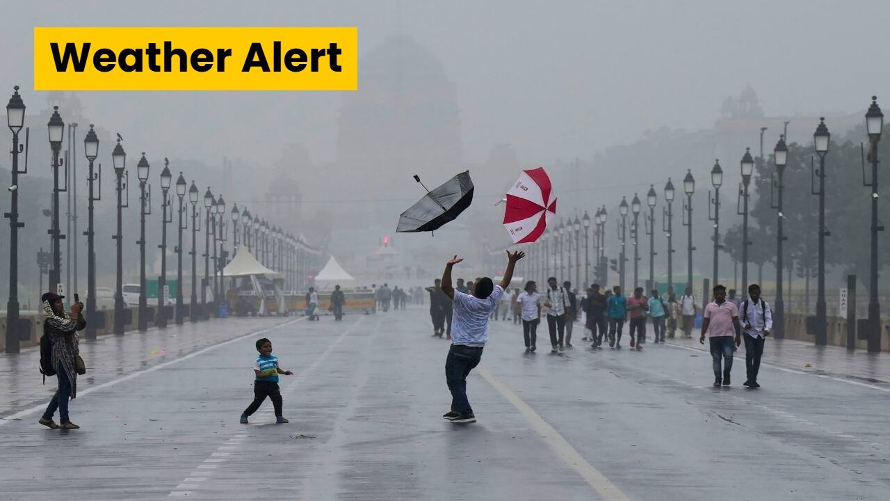
Delhi-NCR Sees Heavy Rain, Fog Returns
Delhi-NCR experienced heavy rainfall on Tuesday, which significantly lowered temperatures across the region. Additionally, dense fog returned after the rain, reducing visibility during late-night and early-morning hours. Therefore, commuters faced slower traffic and increased travel difficulties.
The renewed cold wave has once again tightened its grip on the national capital. Moreover, chilly winds have made outdoor conditions uncomfortable, especially after sunset. According to Dr. Shashikant Mishra, senior scientist at the Meteorological Department, a yellow alert has been issued for Delhi-NCR on February 1.
This alert covers Noida, Ghaziabad, Gurgaon, Faridabad, and surrounding NCR areas. Consequently, residents have been advised to remain cautious, avoid unnecessary travel during foggy hours, and follow weather advisories closely.
Uttar Pradesh Weather Forecast: Rain, Fog, and Strong Winds Ahead
The influence of the Western Disturbance is now spreading further east into Uttar Pradesh. According to the Meteorological Department, rain and thunderstorms are likely in eastern parts of the state on January 28. Additionally, dense fog is expected during the morning and night hours of January 29.
Meanwhile, cloud cover is increasing across the state, reducing sunlight and keeping temperatures low. Previously, easterly winds dominated the region. However, westerly winds have now taken over, bringing slight atmospheric relief but also moisture-laden clouds.
Therefore, heavy rainfall remains possible in some districts over the next three days. Moreover, fluctuating wind patterns may lead to sudden temperature changes, making weather conditions unpredictable.
Rajasthan Weather Update: Rain, Winds, and Hailstorm Warning
Rajasthan is also feeling the strong effects of the Western Disturbance. Light to moderate rainfall is expected in several areas of the state. Additionally, western Rajasthan may experience strong winds blowing at speeds of 30–40 km/h, accompanied by lightning and thunder.
On the other hand, eastern Rajasthan faces a more severe threat, as meteorological officials have issued a hailstorm warning. Consequently, farmers have been advised to take preventive measures to protect standing crops.
Dense fog may develop in some regions during the mornings and nights of January 28 and 29. Moreover, minimum temperatures are likely to drop by 3–5°C over the next two days. However, a gradual rise in temperatures is expected once the Western Disturbance weakens.
Weather Outlook for Madhya Pradesh and Surrounding Regions
Parts of Madhya Pradesh are also experiencing unstable weather due to the same system. Increased cloudiness and intermittent rainfall have led to cooler conditions across several districts. Additionally, cold winds during nighttime are making winter feel more severe than usual.
According to weather experts, the situation should slowly improve after January 28. Nevertheless, residents are advised to remain alert, especially during early mornings and late nights when fog and cold conditions peak.